Sample drone data | UAV Data Sets
Globhe's Free Sample Data page. Explore the capabilities of drone data firsthand through these drone datasets. Here, we offer a selection of complimentary sample datasets that showcase the potential of drone data. Whether you're a seasoned GIS professional, a budding enthusiast, or simply curious about the impact of drone technology, these samples provide a valuable opportunity to dive into the world of high-resolution imagery, LiDAR data, thermal scans, and more for your projects and applications.
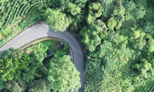
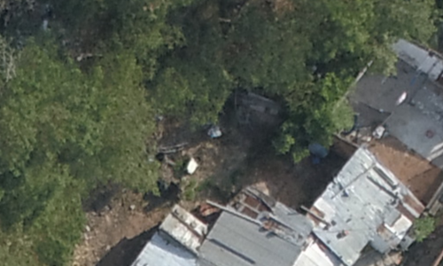
RGB optical drone imagery data

RGB Optical Images
Raw images acquired from a drone-mounted RGB/optical camera capturing visible light information. Agriculture, Environment, Forestry and Infrastructure examples in the kit.
.JPG

RGB Optical Video / footage
Raw images acquired from a drone-mounted RGB/optical camera capturing visible light information.
.MP4

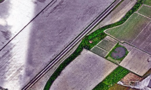
RGB Optical Orthomosaics
Georeferenced and high-resolution images generated by stitching together raw images collected from a drone's RGB/optical camera.
.TIF file 2.66 & 1.66 cm/px

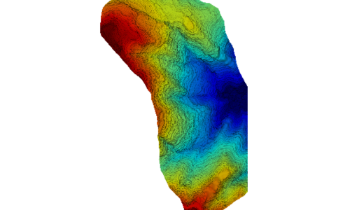
RGB Optical Digital Surface Model (DSM)
A Digital Surface Model produced from RGB drone data that represents the Earth's surface, including structures and vegetation.
.TIF file 9.86 cm/px
RGB Optical Digital Terrain Model (DTM)
A Digital Terrain Model created from RGB drone data depicting the bare Earth's surface, excluding above-ground objects.
.TIF file 9.86 cm/px
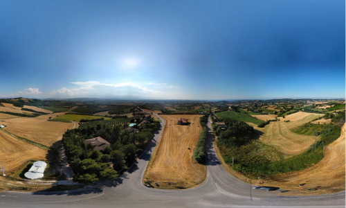
RGB Optical 360 Panorama
360-degree panoramic images obtained from a drone's RGB/optical camera for immersive views.
.JPG

RGB Optical 3D Models
Three-dimensional models of objects or landscapes generated from RGB drone data.
RGB Optical Topographic Maps
Topographic maps created using data from a drone's RGB/optical camera, displaying elevation contours and surface features.
LiDAR drone imagery data

LiDAR Point Cloud
Point cloud data collected by a drone-mounted LiDAR sensor, representing precise 3D locations of objects on the Earth's surface.
.las

LiDAR Digital Surface Model (DSM)
A Digital Surface Model derived from LiDAR drone data, showing the Earth's surface, including structures and vegetation.
Coming soon
LiDAR Digital Terrain Model (DTM)
A Digital Terrain Model generated from LiDAR drone data, depicting the bare Earth's surface without above-ground objects.
Coming soon
Thermal drone imagery data
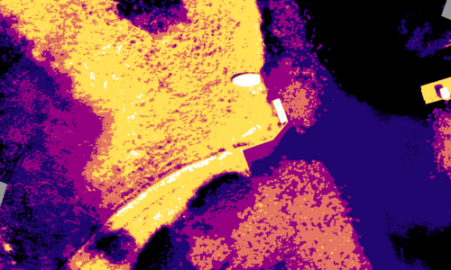
Thermal Images
Raw thermal images captured by a drone-mounted thermal camera, displaying heat signatures.
.JPG
Thermal Video / Footage
Video footage recorded by a drone-mounted thermal camera, providing thermal information in a video format.
.mp4
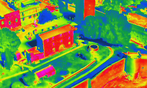
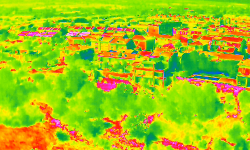
Thermal Orthomosaic
Georeferenced and composite images created by stitching together raw thermal images collected from a drone.
.tif
Multispectral drone imagery data
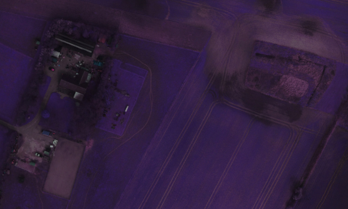
Multispectral Images
Raw multispectral images captured by a drone-mounted multispectral sensor, providing data across various wavelengths.
.JPG
Multispectral Orthomosaic
Georeferenced and composite images generated by stitching together raw multispectral images collected from a drone.
.TIF
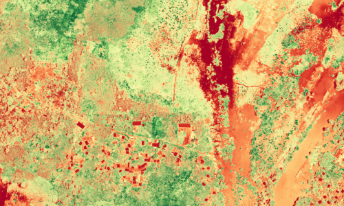
Multispectral NDVI Maps
NDVI (Normalized Difference Vegetation Index) maps created from multispectral drone data, indicating vegetation health and density based on spectral analysis.
.TIF
Near infrared (NIR)
Coming soon
Hyperspectral drone imagery data
Hyperspectral Images
Raw hyperspectral images obtained from a drone-mounted hyperspectral sensor, offering data across numerous spectral bands.
.JPG
Coming soon
Hyperspectral Orthomosaic
Georeferenced and composite images created by stitching together raw hyperspectral images collected from a drone.
.TIF
Coming soon
Infrared drone imagery data (IR)
Infrared
Coming soon
Uncooled infrared / IR
Coming soon
Long-Wave infrared (LWIR)
Coming soon
Medium-Wave Infrared (MWIR)
Coming soon
Short-Wave Infrared (SWIR)
Coming soon
Near infrared (NIR)
Coming soon
Ground Sampling Distance (GSD) drone imagery samples

0.8 cm GSD
0.8 cm GSD delivers unmatched detail, ideal for precision agriculture and intricate infrastructure inspections.
.JPG

1 cm GSD
1 cm GSD balances exceptional detail with broad coverage, perfect for construction and environmental studies.
.JPG

2.5 cm GSD
2.5 cm GSD ensures wide area coverage with good detail, suitable for large-scale mapping
.JPG

3.5 cm GSD
3.5 cm GSD offers extensive coverage with moderate detail, great for urban planning projects.
.JPG
5 cm GSD
5 cm GSD captures large areas efficiently, ideal for agricultural monitoring and forest mapping.
.JPG
8 cm GSD
8 cm GSD provides broad overview imagery, suitable for initial land surveys and large properties.
Updates
The last update to our sample data set was made on February 5, 2024
Task a drone
